Square Miles of Alaska
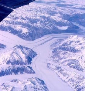
Alaska is a very big state. In fact, it is considered the largest US state by land area. Square miles of Alaska totals to 663,268.
Alaska is a very big state. In fact, it is considered the largest US state by land area. Square miles of Alaska totals to 663,268.
Virginia is one of the states in the U.S. that can be found on the Atlantic Coast. To learn more about the place, it is best to look at the size of Virginia in terms of area and population.
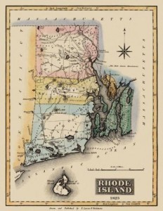
In terms of population, Rhode Island is 43rd in the US. Assess the facts about the size of Rhode Island and how its population has grown and expanded through the years. Analyze data about Rhode Island’s geography and information about its cities.
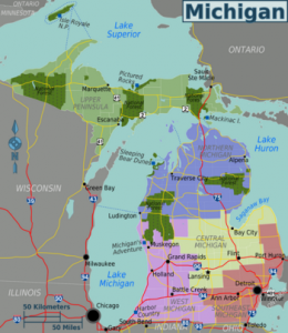
Michigan is the 11th biggest state in the US and has one of the longest freshwater shorelines on the planet. Assess the size of Michigan and how its population has increased through the years. Get information about Michigan’s cities and other geographical data.
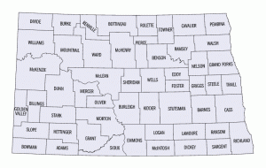
North Dakota is one of the states located in the Midwest region of the U.S. To learn more about the geography of the place, it is best to determine the total area covered and population size of North Dakota.
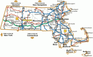
Massachusetts is the 44th biggest state in the US and one of the most historically significant. Get accurate information on the size of Massachusetts, its latitude and longitude. Acquire data about Massachusetts’ demographics, elevation points and the population of its major cities.
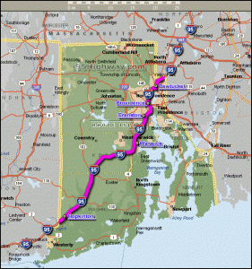
In terms of area size, the smallest US state is Rhode Island. Go through the facts and figures and how the smallest US state compares with other places. Uncover interesting facts about the smallest US state and other fascinating historical data.

Connecticut is a beautiful state located within the northeastern part of the U.S. It goes by the nicknames ‘the Provisions State,’ ‘the Nutmeg State’ and ‘the Constitution State.’ In addition to these interesting details, it is good to learn other facts about the place including the size of Connecticut.
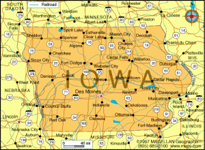
One of the Midwestern states in the U.S., Iowa is known by the nicknames ‘the Tall Corn State’ and ‘the Hawkeye State.’ It lies next to Des Moines River, the…
When measuring the biggest states by size, two methods are employed: by area and population. Measured by population, the biggest would be California with 37,691,912 (as of July 2011). If…
The largest state in America is Alaska. Analyze the facts and figures and discover why it’s the biggest state in the US. Evaluate the population growth of the biggest US state, its geography and demographics.
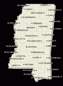
The state of Mississippi is situated within the southern part of the United States. The place is heavily forested and features a vastly developed catfish aquaculture farms. Additionally, there are many other nice things to learn about this state including the size of Mississippi.