Square Miles of Alaska
Alaska is a very big state. In fact, it is considered the largest US state by land area. Square miles of Alaska totals to 663,268.
Alaska is a very big state. In fact, it is considered the largest US state by land area. Square miles of Alaska totals to 663,268.
Virginia is one of the states in the U.S. that can be found on the Atlantic Coast. To learn more about the place, it is best to look at the size of Virginia in terms of area and population.

How big is Broadway? A lot of people impressed that Broadway is only about the famous theater district near Times Square, which is also known as the Great White Way. But it’s not just that because all in all, Broadway avenue is composed of about 400 miles or more of road length.

There are many American flag dimensions, but some sizes are used more often than others. There are also recommended sizes for ground set poles, wall mounted poles and many others. There are different materials used for creating the American flag too.
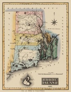
In terms of population, Rhode Island is 43rd in the US. Assess the facts about the size of Rhode Island and how its population has grown and expanded through the years. Analyze data about Rhode Island’s geography and information about its cities.
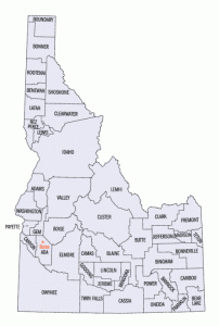
Idaho is the 39th most populous state in the United States. Obtain information about the size of Idaho and how its population has grown through the years. Get population figures for its counties and the important cities in the state.
Australia and the USA are two of the largest countries on the planet. They have unique characteristics, ranging from varied terrains and diverse climates. Compare Australia size vs USA size and discover other facts about these countries.
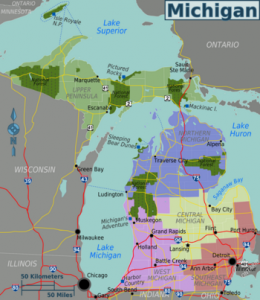
Michigan is the 11th biggest state in the US and has one of the longest freshwater shorelines on the planet. Assess the size of Michigan and how its population has increased through the years. Get information about Michigan’s cities and other geographical data.

The Empire State Building is one of the most famous landmarks in New York City and America. The building has several features, including state of the art elevators. Explore the height of the Empire State Building and how it matches up with other structures.

Silicon Valley is known for being the center of software and Internet development. However, it has been a center of science and technology even back in the early 1900s. Gather facts about the size of Silicon Valley and what products were invented there.
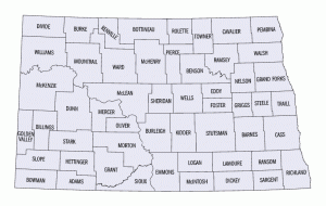
North Dakota is one of the states located in the Midwest region of the U.S. To learn more about the geography of the place, it is best to determine the total area covered and population size of North Dakota.
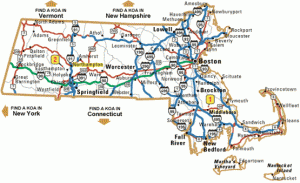
Massachusetts is the 44th biggest state in the US and one of the most historically significant. Get accurate information on the size of Massachusetts, its latitude and longitude. Acquire data about Massachusetts’ demographics, elevation points and the population of its major cities.