What is the size of Missouri?
The area size of Missouri is 69,704 sq mi or 180,533 sq km.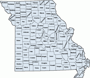 Its width is 240 miles (385 km) and the length is 300 miles (480 km). Its capital is Jefferson City.
Geographical Information
The latitude is 36 degrees, N to 40 degrees, 37’ N and the longitude is 89 degrees, 6’ W to 95 degrees 46’ W. Taum Sauk Mountain is the highest point at 1,772 ft (540 m).
The lowest point is at the St. Francis River at 230 ft (70 m). The mean is 800 ft (240 m). The parks and recreational section total 202,000 acres. The state also possesses numerous river buffs by the Mississippi River.
Population through the Years
The population estimate as of 2008 is 5,911,605. The density is 85.3 sq/mi or 32.95/sq km.
The size of Missouri’s population has grown tremendously compared with the earliest records. The census in 1810 showed it had a population of 19,783. This figure grew to 66,586 ten years later in 1820.
The population grew even more in 1830 (140,455); in 1840 the figure rose to 383,702. By 1860, Missouri’s population had reached 1,182,012. The state broke through the 2 million mark in 1880 (2,168,380).
By 1900, the census estimated the population at 3,106,665. From 1910 to 1950 the population increased by 4 to 6%, reaching 3,954,653 in 1950. The 1960 census revealed the population was 4,319,813. The population figure passed the 5 million mark in 1990 when the figures showed there were 5,117,073 individuals there.
Major Cities
If the sizes of Missouri’s cities are judged by population, Kansas City is the biggest with a population of 441,545. The next is St. Louis with 348,189 followed by Springfield with a population of 151,580.
Independence is number four with a population of 113,288. Columbia is at five with 84,531. St. Joseph is at number six with 73,990; Lee’s Summit is at 7 with a population of 70,700. St. Charles is at eight with a population of 60,321.
At number nine is St. Peters (51,381) and ten is Florissant (50,497) and at 11 is Blue Springs (48,080). Chesterfield is at number 12 with a population of 46,802 and O’ Fallon is at 13 with a population of 46,169.
Joplin is the 14th most heavily populated with 45,504. The capital, Jefferson City is at number 15 with 39,386 residents.
Size of Missouri’s Counties
Missouri has 114 counties. The US Census for 2008 state that the average population of the counties is 51,405. Worth County has the lowest population at 2,039. St. Louis is the most heavily populated with 991,830.
The land area is 699 sq mi (1,551 sq km) on the average. The largest in terms of land area is Texas County at 1,179 sq mi (3,056 sq km). St. Louis is the smallest at 62 sq mi (161 sq km).
Some of the other counties are Adair County (568 sq mi / 1,471 sq km), Barton County (591 sq mi or 1,537 sq km), Callaway County (839 sq mi or 2,173 sq km) Saline County (756 sq mi or 1,958 sq km).
The size of Missouri’s population, both in the cities and counties change from year to year. Also keep in mind the population given are only estimates.
