How Big is United Kingdom?
The sovereign state of the United Kingdom of 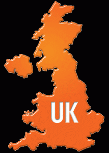 Great Britain and Northern Ireland is situated some distance off the northwestern coast of the European continent. Commonly called as the United Kingdom, Britain, or the UK, the state is actually an island country that spans to an archipelago composed of Great Britain, Northern Ireland, and some small islands. The only portion of the kingdom that has a land border is Northern Ireland since it is sharing the island with the Republic of Ireland. The kingdom is enclosed by bodies of water namely the Irish Sea, the English Channel, the North Sea, and the Atlantic Ocean. Great Britain is the largest island of the UK and it is connected to France through the Channel Tunnel.
Total Area
The United Kingdom has an estimated total land area of 245,000 square kilometers of 94,600 square miles. It is mainly composed of the entire island of Great Britain, the northeast part of the island of Ireland called as the Northern Ireland, and smaller islands within the territory. The UK is lying in between the North Sea and the North Atlantic Ocean. It is about 35 kilometers or 22 miles away from the northwest coast of the country of France with the English Channel in between them.
The island of Great Britain has a north-south length of a little over 1,100 kilometers or 700 miles. The widest portion of the United Kingdom is a little under 500 kilometers or 300 miles. The distance between Land’s End in Cornwall and John o’Groats in Caithness is the greatest distance between two points in the UK and it measures about 1,350 kilometers or 840 miles. The land boundary shared between the Northern Ireland and the Republic of Ireland is about 360 kilometers or 224 miles in length.
England
England has a total land area of 130,410 square kilometers or 50,350 square miles, covering more than half of the United Kingdom. The highest mountain in England is Scafell Pike with an elevation of 978 meters or 3,209 feet. A number of the big towns and cities in England are included in the top 50 Larger Urban Zones within the European Union.
Scotland
Scotland has a total land area of 78,772 square kilometers or 30,410 square miles, covering almost one-third of the total area of the UK. Scotland also includes almost 800 islands located mostly on the western and northern coast of the mainland. Some of these islands are Shetland Islands, Orkney Islands, and the Hebrides. The highest elevation in the British Isles is located in Scotland and it is Ben Nevis with a height of 1,343 meters or 4,406 feet.
Wales
Wales has a total land area of 20,758 square kilometers or 8,010 square miles covering about one-tenth of the United Kingdom. Wales has a coastline of more than 1,200 kilometers or 750 miles. Off the coast of the mainland of Welsh are some islands and the largest of these islands is the Anglesey which is located in the northwestern side.
Northern Ireland
Northern Ireland has a total land area of 14,160 square kilometers or 5,470 square miles and is mainly composed of hills. The biggest body of water in Ireland as well as in the UK is found in Northern Ireland and it is Lough Neagh with a surface area of 388 square kilometers or 150 square miles.
